


Tampa’s Hurricane Risk
Risk vs. Reality
If you live in (or invest in) Tampa Bay, you’ve seen the spaghetti models and “cone of uncertainty” headlines every season. But the historical record tells a different story than the hype: direct hurricane landfalls in Tampa are uncommon. Only two reliably documented direct hits sit in the modern record—and they’re far apart in time.
A Short Timeline of True Direct Hits
1848 — “Great Gale of 1848” (Estimated Cat 4): A powerful hurricane drove Tampa Bay water levels roughly 15 feet above mean low water, inundating what’s now South Tampa and reshaping parts of the coastline.
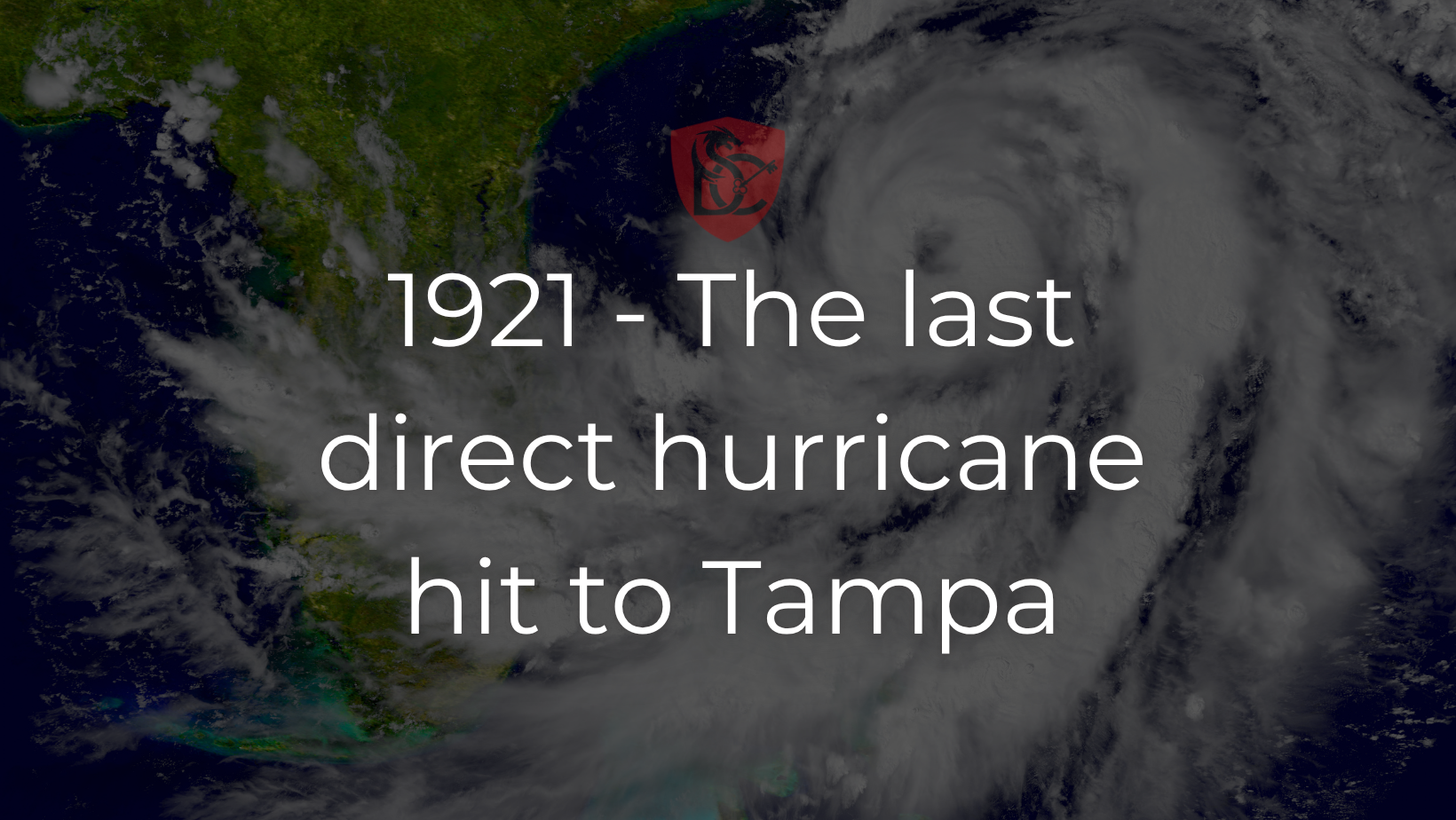
1921 — Tampa Bay / Tarpon Springs Hurricane (Cat 3): On October 25, 1921, the region took a major strike. Tampa saw widespread flooding, with storm surge generally in the 10–12 foot range. It remains the most recent direct major-hurricane hit on the Tampa Bay area.
Those are the marquee landfalls. Since then, Tampa Bay has had many close calls—storms that veered, weakened, or made landfall to the north or south—creating an impression of constant risk without frequent bullseye strikes.
Recent “Near Misses” That Fueled the Perception
Hurricane Idalia (2023): Significant coastal flooding around the bay, but landfall occurred well north of Tampa Bay. The area again avoided a direct major-hurricane strike.
Hurricane Helene (2024): Another heavily watched track that ultimately spared Tampa a direct hit, echoing a long pattern of last-minute shifts or weakening before arrival.
So… What Are the Odds of a Direct Hit in Any Given Year?
Based on the analysis in the source you shared, the annual probability is about 1.14%—roughly a 1-in-88 chance in a given season. That’s much lower than many assume when they only see the forecast cones on TV.
Note: Odds vary depending on how you define “direct hit,” methodology, and time window, but the big picture remains: Tampa’s direct landfalls are rare compared to the number of threats that show up on seasonal maps. For broad historical context, see NOAA’s landfalling hurricane archives.
Why Tampa Often “Dodges” the Bullseye
There’s no scientific “bubble,” but geography and steering patterns matter. Storms approaching from the south often curve north-northeast along the Gulf, sometimes making landfall north or south of the bay or weakening before arrival. Combine that with shallow bay waters and regional track idiosyncrasies, and you get lots of threats, few direct hits.
What This Means for Homeowners & Investors
1) Insurance planning matters—even with rare direct hits.
Wind and flood coverage remain core parts of a Tampa risk plan. Surge-prone neighborhoods should also weigh elevation, flood vents, and impact protection. (Idalia’s flooding is a useful reminder.)
2) Property selection can de-risk the downside.
Look for stronger roof assemblies, modern window/door systems, and elevation advantages. Post-Andrew building practices generally raised the bar statewide; newer construction typically performs better in wind events. (Verify features in the permit history and inspection reports.)
3) Underwriting should reflect real (not imagined) probability.
The historical record shows that headline risk ≠ realized risk in Tampa. If competitors overestimate direct-hit frequency, that can create pricing inefficiencies for savvy buyers who budget realistically for wind, surge, and downtime.
4) Preparedness beats bravado.
Even a “glancing blow” can push water into the bay or knock out power. Make a checklist: shutters or panels, roof tie-downs, sump/back-flow considerations, tree trimming, and a communications plan for tenants.
Tampa’s historical record shows only two true direct hurricane landfalls—1848 and 1921—despite many high-profile close calls. The annual odds of a direct hit are low, but complacency isn’t a strategy. Even non-direct hits can cause significant wind or water damage if near bodies of water or large trees. The smart approach is to prepare, insure wisely, and invest with a clear view of actual (not imagined) risk. That way, you can benefit from Tampa’s growth story while staying resilient when the next storm threatens.


Check out this article next